


Dades

JMHRX2
User

Length
508 m

Max alt
1634 m

Uphill gradient
14 m
Km-Effort
658 m

Min alt
1616 m

Downhill gradient
3 m
Boucle
No
Creation date :
2024-07-24 17:00:10.743
Updated on :
2024-07-27 16:33:41.967
12m
Difficulty : Easy

FREE GPS app for hiking
 SityTrail
IGN / Geographical institutes
SityTrail Plus
The world is yours!
About
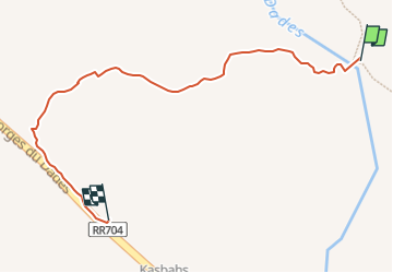
Trail Walking of 508 m to be discovered at Drâa-Tafilalet, cercle de Boulmane-Dadès, Ait Sedrate Jbel El Soufla. This trail is proposed by JMHRX2.
Positioning
Country:
Morocco
Region :
Drâa-Tafilalet
Department/Province :
cercle de Boulmane-Dadès
Municipality :
Ait Sedrate Jbel El Soufla
Location:
Unknown
Start:(Dec)
Start:(UTM)
217650 ; 3483987 (30R) N.
Comments